
The Parish of Bratton extends from Dunge in the north into the Salisbury Plain military ranges to the South.
Click here for the map of the Parish, showing scheduled monuments. 


Bratton has a wide range of footpaths and bridleways that enable residents and visitors to enjoy safe walking, riding and cycling, away from vehicular traffic.
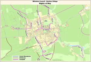
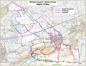
For maps of public rights of way in the Parish, please click here
Do have a look at some of the delightful views in our photo gallery click here
(We shall also be providing maps of interesting walks and sights of special interest when these are available.)